
A Guide to Workflows within Autodesk Infraworks
Online course |
|
50 hours / 6 weeks |
|
Dates: to be determined |
Get access to our job listing after finishing the course
Introduction
The way in which cities and towns – and the AEC (Architecture, Engineering and Construction) firms that support them – plan, build and manage their infrastructure is changing.
Global challenges such as increasing urbanisation, the pressure of having to do more with fewer resources, aging infrastructure and the need for increased transparency and public accountability mean that planners, designers and engineers can no longer work in an isolated environment.
With BIM (Building Information Modelling) becoming more ubiquitous around the world, it’s becoming increasingly important for AEC firms to ensure that they can comply with standards and stay competitive.
Autodesk Infraworks is a tool which enables designers to use intelligent data and connected workflows in order to better plan, design, build and manage infrastructure projects.
Objectives
In this course, students will learn the skills needed to work with the main tools within Infraworks to complete tasks required within a typical project workflow. This includes building models, sourcing data, doing preliminary design of infrastructure, and visualising and sharing the results.
Students will complete tasks typically required to support BIM processes on an Infrastructure project. The goal of this course is to provide students with the basic knowledge they need to immediately work within Infraworks and create output which can be consumed within other phases of the BIM cycle.
The course is presented through video tutorials and multimedia content within the Moodle virtual platform, with exercises like tests and practical cases, along with live webinars.
Limited places.
Contents tab
Week 1
- Course Introduction
-
- – Course Goals
- – Instructor Introduction
- Interface Overview
- Creating a Model
- Sourcing and Adding Additional Data to a Model
Week 2
- Working with a Model
-
- – Configure and style Data
- – Manage Proposals
- – Add, Modify and Change Features
- – Theme Model Data
- – Use Expressions to Add Custom Styling and Tooltips
- – Measure and Analyse Data within a Model
Week 3
- Roadway Design
-
- – About Roads within Infraworks
- – Create Roads
- – Edit Roads
- – Work with Intersections
- – Analyse Roads
- – Optimise Roads
- – Traffic Simulation
- – Share Infraworks Results
Week 4
- Drainage Design
-
- – Flood Simulation
- – Creating Drainage Networks
- – Optimising Drainage Networks
- – Watershed Analysis
- – Share Infraworks Results
Week 5
- Bridge and Tunnel Design
-
- – Create a Bridge
- – Work with Bridge Components
- – Create Parametric Bridge Components
- – Share Infraworks Bridges
- – Create a Tunnel
- – Modify Tunnel Segments
- – Share Infraworks Tunnels
Week 6
- Visualising and Sharing a Model
-
- – Working with 3D Models
- – Visualisation Settings
- – Work with Atmospheric and Water Effects
- – Create and Share Presentations
Lynda Sharkey
Lynda Sharkey is a technical specialist, software prototyper, product manager, and technical marketer.
Over the last 19 years, Lynda has worked with business partners throughout Europe, the USA, and South Africa. She continues to be amazed at the myriad ways in which GIS and design technology can be used to build stronger, more resilient infrastructure, and more sustainable communities.
She is almost Labrador-like in her enthusiasm to share that knowledge with anyone who cares to listen.
Her most recent corporate position was as a product manager responsible for developing, prototyping, and bringing to market sustainable city and transportation solutions; however, she has eschewed the rat race, moved to Spain, and is now a freelance technical content creator, instructor and technical marketer. She also runs a small adventure-motorcycle rental and tour company with her husband.
Within this virtual platform, students are in continuous contact with professor in a tailored way, solving questions together, and widening knowledge and acquiring new skills. Students can also interact with other students and professors through webinars and forums.
This course is aimed at students, recent graduates and professionals who want to learn to use Autodesk Infraworks as part of a workflow that will enable them to combine GIS data, CAD data and BIM processes to visualise infrastructure concepts, optimise them, and share them with both technical and non-technical stakeholders.
As evidence of knowledge gained throughout the course, a certificate will be issued from the Virtual platform. This certificate is based on the modern technology Blockchain, which increases security, prevents fraud, builds trust and ensures you’re ready for the future.
This course is aimed at students, recent graduates and professionals who want to learn to use Autodesk Infraworks as part of a workflow that will enable them to combine GIS data, CAD data and BIM processes to visualise infrastructure concepts, optimise them, and share them with both technical and non-technical stakeholders.
More info
Finish this course and get a certificate based on Blockchain
A Guide to Workflows within Autodesk Infraworks
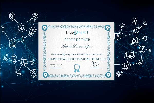
Blockchain technology makes the certificate incorruptible, enabling companies to verifiy its autenticity.
Reviews
There are no reviews yet.