
Basic roadway design using Autodesk Civil 3D
Online course |
|
50 hours / 6 weeks |
|
To be determined |
Introduction
Upon completion of this course, individuals will be able to complete a basic Roadway design in Autodesk Civil 3D.
It is recommended that you have a working knowledge of Autodesk before enrolling in this course. Some knowledge of Civil 3D projects would be an asset.
Objectives
1. Civil 3D Interface and Civil 3D Settings
Section Learning Objective
- Familiarize the location of the various Ribbons, Commands and Toolspace, etc.…
- Using the Prospector, Settings and Toolbox tabs
2. Surfaces
Section Learning Objective
- Adjusting and editing Surface properties
- Analyze a surface using quick profile and object viewer
- Volume calculation using surfaces
3. Alignments and Profiles
Section Learning Objective
- Creating alignment
- Station numbering and labels
- Creating surface profiles
- Creating propose profiles
- Station numbering and labels
4. Corridors
Section Learning Objective
- Typical section assembly
- Create corridor
- Create propose surface from corridor
- View final corridor from driving the road virtually
5. Cross Sections
Section Learning Objective
- Create cross-section from existing and propose corridor
- Create cross-section view
6. Volumes
Section Learning Objective
- Calculate volumes and materials from corridor
Limited places.
Week 1. Civil 3D Interface and Civil 3D Settings
- – Introduction
- – Ribbon / Application Menu
- – Quick Access Toolbar
- – The Toolspace
- – Command Line / Status Bar
- – Creating Label Styles
Week 2. Surfaces
- – Creating and defining surfaces by point groups
- – Defining a surface by Edits
- – Surface Properties and Surface Styles
- – Volume Surfaces (Cut and Fill)
Week 3. Alignments and Profiles
- – Surface Styles
- – Alignment Labels
- – Profile from Surface
- – Profile Styles and Labels
- – Bands
Week 4. Corridors
- – Cross-Section or Assembly
- – Corridor Creation
- – Corridor Frequencies
- – Corridor targets
Weel 5. Cross Sections
- – Creating sample lines
- – Creating Cross Sections
- – Sections view group properties
- – Bands
Week 6. Volumes
- – Material list
- – Material Tables
Rhoshell Baker, B.Sc., C.E.T.
Designer in the Transportation and Land Development Department with over 20 years of experience in various roadway design and land development projects both Greenfield and Redevelopment. Experiences ranges in Municipal Engineering including subdivision, site plans, underground servicing, roads, grading and earthworks. Exposure to a variety of multidisciplinary infrastructure projects including preliminary investigation, detail design, functional servicing, site plan, and Light Rail Transit.
Education and experience:
- – Bachelor of Science, Electronics Engineering (2000)
- – Associate of Science, Civil Engineering (2004)
- – 2020 to Present: Private Firm (Transportation Technologist)
- – 2020 to Present: Georgian College (Professor)
- – 2018 to Present: Durham College (Professor)
- – 2001 – 2019: Private Firm (Transportation Technologist)
- – 1996 – 2001: Electronics Engineer Technologist
The course is run in an online format. Throughout our innovative and powerful Virtual Campus, a dynamic and flexible environment is provided so the student can follow the course at his or her pace.
Within this virtual platform, students are in continuous contact with professor in a tailored way, solving questions together, and widening knowledge and acquiring new skills. Students can also interact with other students and professors through webinars and forums.
Plenty of content can be found in the Campus: eLearning material, videos, technical articles, manuals, complementary documentation, real examples and exercises.
This course is aimed at individuals who are just entering the civil engineering field as well as those who are already in the field and want to enhance their knowledge and skills in planning, designing, drafting, and editing civil engineering projects. This Civil 3D course will also be additional training for individuals that are civil engineering technologists/technicians, architectural technologists/technicians, engineers, planners, contractors, drafters, CAD professionals and related consultants who want to improve their civil engineering and land planning skills.
As evidence of knowledge gained throughout the course, a certificate will be issued from the Virtual platform. This certificate is based on the modern technology Blockchain, which increases security, prevents fraud, builds trust and ensures you’re ready for the future.
Upon completion of this course, individuals may be able to obtain employment as a Roadway Designers, and Drafters; Municipal Designer and or Land Development Designer working on projects including but not limited to highways, bridges, water and sewage systems, subdivisions, and site-plan projects.
More info
Finish this course and get a certificate based on Blockchain
Basic roadway design using Autodesk Civil 3D
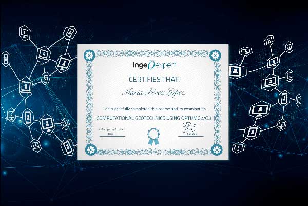
Blockchain technology makes the certificate incorruptible, enabling companies to verifiy its autenticity.
Reviews
There are no reviews yet.