
Seismic interpretation on 2D and 3D
Online course |
|
50 hours / 6 weeks |
|
|
Dates: 15th of April to 27th of May Registration period extended until 29th of April
|
| Standard | Unemployed Or Student |
| $292 | $216 |
Introduction
Reflection seismic is one of the fundamental ways of imaging the subsurface from a geological perspective. 2D and 3D seismic data is a major source of information in the oil industry for both onshore and offshore activities. Knowledge of a sedimentary basin from the perspective of oil systems often begins with the acquisition and analysis of widely spaced 2D seismic data, forming a quadrangular mesh and covering large areas – the regional lines. Based on this analysis, the main petroleum systems or plays (albeit hypothetical) are defined as well as the areas of major interest, where the probability of hydrocarbon accumulations is higher. These areas are then targeted for new, more detailed seismic acquisition campaigns – 2D with a tighter mesh and smaller areas or 3D in very specific areas. These new data are the basis from which potential drilling targets are defined to test for the presence of hydrocarbons and the productivity of the reservoirs containing them. If drilling is successful, seismic data will allow (calibrated with well data) to assess the extent of accumulation and to envision new drilling targets. Even during the production of an oilfield, seismic data remains relevant, for example with the use of 4D seismic – second 3D acquisition with the same parameters in the same area – to assess the amount of hydrocarbons still present.
Recently this type of data has also been used in geothermal energy activities, carbon sequestration in geological reservoirs and wind energy, especially offshore. Other uses include mapping salt structures for use as natural gas reservoirs (gas caverns), delimiting mineral deposits among other activities involving imaging of the subsurface.
This course will cover the main concepts underlying the interpretation of 2D and 3D seismic data, from its History, the methods of data acquisition, processing, visualization and software. Several mapping exercises will be done using seismic data – faults and horizons – and how they can be used to understand the structure, stratigraphy and geodynamics of a basin.
The perspective of hydrocarbon resources will be addressed through reserve and associated risk calculation exercises.
Objectives
The main objective of this course is to prepare geologists, geological engineers and other professionals and students for the use of seismic data in their activity, particularly in the oil industry. Several examples of tools, test data and interpretation techniques will be given that will enable participants to continue their training during and after the course.
During the course and in an organized and systematic manner, we aim to achieve several objectives that are briefly presented:
- General understanding of seismic data acquisition methods
- Understand other data sources used in conjunction with seismic
- Understand seismic data processing
- View seismic data and know how it can be adapted
- Know the various software programs
- Know the various types of data and licenses
- Map geological faults
- Identify structure types and geodynamic environments
- Build simple structural models
- Map 2D and 3D horizons
- Use seismic attributes to identify sedimentary macrostructures
- Identify seismic facies
- Build Wheeler diagrams
- Interpret sequence stratigraphy in a generic way
- Know the elements and processes of the petroleum system
- Map hydrocarbon accumulations
- Quantify a hydrocarbon accumulation
- Determine the risk associated with a hydrocarbon accumulation
Limited places.
Week 1
1. Introduction
- – History of seismic studies
- – The seismic methodd
- – Other geophysical methods
- – Seismic data processing overview
- – Calibration methods (well-tie)
Week 2
1 . 2D and 3D Seismic Data
- – Parameters, visualization, polarity
- – Seismic Data Libraries, public, private and licenses
- – Software
2. 2D and 3D interpretation techniques
- – Hard and soft events
- – Vertical exaggeration
- – Horizontal and vertical slicing in 3D data
- – Seismic horizons – stratal interface, fluid contacts and non-geological horizons
3. Quantitative interpretation geophysics
- – Acoustic impedance and inversion
- – AVO and pseudo-gradient
- – RMS amplitude
- – Spectral decomposition
- – Other methods
Week 3
1. Fault interpretation
- – Introduction to fault interpretation
2. Structural styles
- – Rift basins
- – Compressional domains
- – Salt tectonics
- – Strike-slip faults
3. Mapping faults in 2D data
- – Faults in each seismic line
- – Connecting faults from different seismic lines
- – Building fault planes
4. Mapping faults in 3D data
- – Mapping faults in vertical and horizontal slices
- – Building fault planes
5. Structural models
- – Building a structural model
- – Visualization
- – Geometry, kinetics, geodynamics
- – Palinspastic Reconstructions
Week 4
1. Stratigraphic interpretation
- – Horizon interpretation techniques
- – Horizon attributes
- – Continuity and lateral variations
- – Unconformities and stratal terminations
2. Seismic facies
- – Carbonate systems seismic facies
- – Siliciclastic systems seismic facies
- – Gross depositional environments
3. Advanced stratigraphic interpretation
- – Wheeler diagrams
- – Seismic sequence stratigraphy
Week 5
1. The petroleum system elements and processes
- – Reservoir
- – Seal
- – Source rock
- – Trap
- – Timing and migration
2. Mapping hydrocarbon accumulations
- – Structural traps
- – Stratigraphic traps
- – Mixed traps
3. Volumetrics
- – Leads, prospects, reserves, resources
- – Volumetric calculation methods
- – P10, P50, P90 and mean
4. Risking
- – Risking methods and software
- – Evaluation of CoS, PoS
- – Incorporation of Geological risk into economic evaluations
Gil Machado
Gil Machado holds a degree in Geology and a European Doctorate (PhD) in Stratigraphy and Petroleum Geology and has ca. 10 years of experience in the Oil&Gas industry, in exploration projects of Oman, Mozambique, Brazil, Angola, Guinea-Bissau, Senegal, Gabon, Morocco, and other Atlantic basins. He is an advanced seismic interpreter, including sediment fairways identification, deep water sedimentation characterization, sequence stratigraphy and prospect generation and risking. He has worked extensively with well correlation, biostratigraphy, regional prospectivity studies and has managed teams and projects in multiple cultural environments.
He has mentored and supervised Bsc and Msc students, young professionals and taught several short courses and lectures on these subjects.
As part of his career he worked at Petroleum Development Oman as a Stratigrapher where he was responsible for the Precambrian and Lower Paleozoic stratigraphy studies and for the scientific management of the palynology laboratory of the company. He followed multiple wells as operational stratigrapher providing real time advice to the well geologists for casing points, TD calls, etc. He also contributed to the biostratigraphic zonation review of the subsurface of Oman.
He is affiliated with the European Association of Geoscientists and Engineers, the PESGB and founder and member of the Portuguese Association of Geoscientists and Engineers.
Gil Machado is currently heading a geological consulting company – Chronosurveys – providing services and training in Stratigraphy, source rock evaluation, Petroleum Geology.
The course is delivered online through our easy-to-use Virtual Campus platform. For this course, a variety of content is provided including:
– eLearning materials
– Videos
– Interactive multimedia content
– Live webinar classes
– Texts and technical articles
– Case studies
– Assignments and evaluation exercises
Students can download the materials and work through the course at their own pace.
We regularly update this course to ensure the latest news and state-of-the-art developments are covered, and your knowledge of the subject is current.
Live webinars form part of our course delivery. These allow students and tutors to go through the course materials, exchange ideas and knowledge, and solve problems together in a virtual classroom setting. Students can also make use of the platform’s forum, a meeting point to interact with tutors and other students.
The tutoring system is managed by email. Students can email the tutor with any questions about the course and the tutor will be happy to help.
The course is designed for geophysicists, geologists, geology engineers, or students who are interested in gaining or deepening practical knowledge about 2D and 3D seismic interpretation and its uses in the oil industry or other industries where knowledge and visualization of subsurface is important.
Prior knowledge of geology and physics basics will be beneficial to participants. No prior software knowledge is required, but some exercises will be done using OpendTect, a free seismic interpretation software.
Once a student finishes the course and successfully completes the assignments and evaluation tests, they are sent an accreditation certificate. The certificate is issued by Ingeoexpert to verify that the student has passed the course. It is a digital certificate that is unique and tamper-proof – it is protected by Blockchain technology. This means it is possible for anyone to check that it is an authentic, original document.
You will be able to download the certificate in an electronic format from the Virtual Campus platform. The certificate can be forwarded by email, shared on social networks, and embedded on websites. To see an example, click here.
As an essential tool for any geoscience professional, knowledge and experience in seismic interpretation will help employability in the following types of institutions:
- – Oil & Gas companies engaged in exploration and production
- – Geoscience Consulting and Service Companies
- – Geothermal Exploration, Wind Energy and Carbon Sequestration Companies
- – Public natural resource management institutions
3 reviews for Seismic interpretation on 2D and 3D
More info
Finish this course and get a certificate based on Blockchain
Seismic interpretation on 2D and 3D
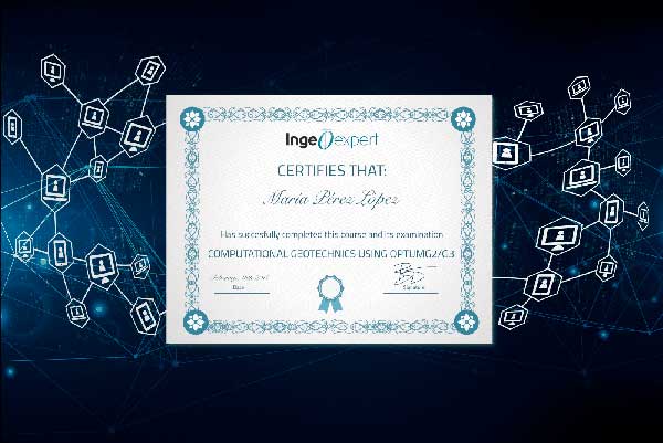
Blockchain technology makes the certificate incorruptible, enabling companies to verifiy its autenticity.
Seismic interpretation on 2D and 3D
| $292 | $216 | |
| Get more information |
Al-Amin Habib Abba Jato –
I would be glad to take the course again. It has really enlighten me in some aspect I was more or less not keen on delving into (risk). Hoping you have more progressive courses which I will join subsequently.
Shireen Akhter –
I really enjoyed the course because I learned a lot by taking advantage of my flexible schedule. If you are interested in geoscience, this course is for you. Simply go get it.
Vanessa Pires –
The interesting part abaout this course is that we can see how it’s done on a software and the final look.