Seismic tomography is a technique for imaging the subsurface of the Earth based on seismic waves produced by earthquakes or seismic activity.
Over recent weeks tomography has gained media attention after it was applied to one of the 7 Wonders of the World; the Pyramids of Egypt.
The news is very interesting in terms of human knowledge. An international team of scientists has used the flow of muons (elementary particles produced when cosmic rays collide with atoms in the Earth’s atmosphere) to scan the inside of the Great Pyramid of Giza, Egypt. Using this variant of the tomography technique a large chamber has been discovered that until then had been hidden behind the walls of the construction and which could reveal new mysteries hidden in the famous and ancient structure.
What is tomography?
Tomography is a technique that processes images of the body by sections. A tomograph is the device used to take these images, and the result, i.e. the image, is called a tomogram. The mathematical procedure that enables this process is tomographic reconstruction.
This procedure enables us to find out the topography of the different geodynamic units of the Earth. For example, it has been used to generate the topographical profile of the surface of the Earth’s interior.
There are several branches of tomography. One is seismic tomography.
Related: Geology Courses
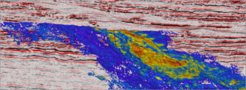
When we talk about seismic tomography we are referring to the technique that can scan the internal structure of the Earth, under its surface, based on reading data that is reflected as images. This data is gathered through seismic or earthquake activity.
The images produced can be 2D or 3D and reflect the faults under the Earth’s surface. The accuracy of the model produced largely depends of the availability of seismic data to create it.
It is a fairly modern procedure, which only came into use in the 1970s when the data gathered by seismographs started to be documented more accurately.
Uses of seismic tomography
The information gathered through seismic tomography is used by researchers to improve their knowledge of areas like:
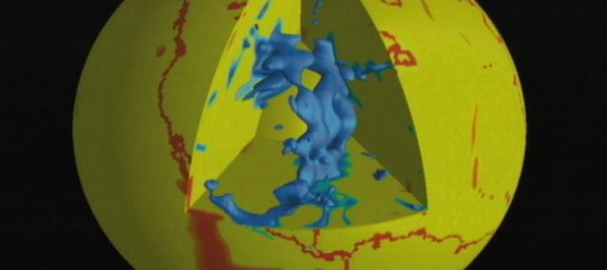
- Processes of the Earth’s core.
- Plate tectonics.
- Analysis of volcanic areas, such as those found at Yellowstone.
As its name suggests seismic tomography gathers data mainly from areas with seismic activity. This means that less data is gathered in vast regions of the Earth with lower seismic activity and as a result, the graphic models generated through tomography are not as accurate as those shown in other areas. By obtaining results from the data gathered from earthquakes and similar events, seismic tomography is dependent on these events.
Other types of tomography
There are different types of tomography other than seismic tomography. The aforementioned, used in the Pyramids of Egypt, is muon tomography and the data source used to sketch out the result is precisely this particle.
X-ray tomography, positron emission tomography, optical coherence tomography, electron cryotomography, and magnetic resonance tomography are other examples of this technique, which are applied in diverse areas like oceanography, physics, material science, astrophysics, archaeology, biology and radiology.
Source: El País.