
Geophysical methods for engineering, construction and mining
Online course |
|
50 hours / 6 weeks |
|
To be determined |
Introduction
Geophysical methods aim at exploring, imaging, and monitoring the subsurface and provide a cost-effective and powerful toolbox for optimizing construction and engineering projects. They are applied for a wide range of tasks such as resource exploration, site investigation, geotechnical parameter estimation, hazard assessment, or short- and longtime environmental monitoring. Depending on the regulator, geophysical investigations are often mandatory within larger infrastructure projects. The different methods might be applied on the surface, below ground (e.g., in tunnels), in boreholes, or even airborne (e.g., drones). The methods are also highly scalable and can be employed to image and monitor the subsurface ranging from shallow soil structures to reservoirs in several kilometers of depth. Present and future challenges of all societies revolve around the ever-growing demands for energy, water, and raw materials, increased urbanization pressure, and mitigation of natural hazards due to climate change, which all require a better understanding and quantitative data of the earth beneath our feet.
Given this versatility and wide range of potential applications, a solid and up-to-date understanding of geophysical methods is highly beneficial for geo-technicians, civil engineers, and geologists alike. In order to judge if and which geophysical methods can be beneficial for a specific task, a general knowledge of the methodologies is required. This concerns both the theoretical foundations, the practical applications, and last but not least the economic aspect of a geophysical campaign.
Objectives
This course will provide you a general understanding of geophysical methods with an emphasis on their role in engineering, construction, mining, and similar applications scenarios. You will learn to judge if and how geophysics can be beneficial for your project, and what are the right questions to ask when talking to a geophysical contractor. The course is also relevant to anyone who wants to broaden her/his knowledge and skill set in the fields of geology, hydrology, geotechnics, geomechanics, or resource exploration. The course is divided into several modules focusing on specific geophysical methods and their practical relevance for other disciplines with an emphasis on engineering and construction.
Specifically, the course focuses on methods which are most relevant to the shallow subsurface:
- Seismic
- Ground Penetrating Radar (GPR)
- Electrical Resistivity
- Gravimetry and Magnetics
Each method is introduced through its theoretical foundation, practical application, data processing, and data interpretation. Throughout the course, real-world examples are used to illustrate the relevance of geophysical data for other professions and disciplines.
Limited places.
Module 1: Introduction
- – Geophysics in a nutshell: What is it and who uses it?
- – Benefits and limitations of geophysical data
- – The typical geophysical workflow: From data acquisition to data interpretation
- – Engineering, construction, mining: The specific challenges of the shallow subsurface
Module 2: Seismic method
- – Seismic waves
- – Seismic properties of the subsurface and their relation to geotechnics and geomechanics
- – Seismic methods and seismic data acquisition
- – Seismic data products and their interpretation
Module 3: Ground penetrating radar (GPR)
- – Electromagnetic waves
- – Electromagnetic properties and their relation to water content in the subsurface
- – GPR instruments and data acquisition
- – Interpretation of GPR data
Module 4: Electrical resistivity method
- – Ohm’s law revisited
- – Electrical resistivity and how it is governed by lithology and water content
- – Electrical resistivity data acquisition and inversion
- – Interpretation of electrical resistivity data
Module 5: Gravimetry and magnetics
- – Potential field methods
- – Density and magnetic susceptibility as rock and medium properties
- – Gravimeters and magnetometers
- – Interpretation of gravimetric and magnetic data
Module 6: Practical aspects
- – The economic aspect of a geophysical campaign
- – Planning and executing a geophysical survey
- – Ambiguity of geophysical data and how to mitigate them
- – Criteria to decide if and which geophysical methods are suitable for a specific task
- – How to choose a geophysical contractor
Michael Behm
Dr. Michael Behm graduated from Technical University in Vienna in 2006 with a PhD in Engineering Sciences focusing on geophysics. He worked as a university assistant in both teaching and research in the fields of crustal seismology and near-surface geophysics until 2011, when he left for Colorado School of Mines in the US. There he conducted research in passive seismology, both in cooperation with ExxonMobil and the Department for Civil Engineering. From 2013 to 2016, Dr. Michael Behm was working as Geophysical Expert in the Austria-based oil & gas producer OMV where his tasks included seismic acquisition, seismic monitoring, non-seismic methods (CSEM, gravity, magnetic) and R&D coordination. From 2017 to 2020, he was Assistant Professor for Applied Geophysics at Oklahoma University. There he conducted research and teaching in the fields of seismic processing, passive seismology, and near surface geophysical methods such as ground penetrating radar, electrical resistivity, gravity, and magnetics. Since 2021, he is working for the Austria based engineering firm Geodata Group, and is specializing on application of geophysics for tasks such related to infrastructure (e.g., tunneling, natural hazards, construction).
Dr. Michael Behm has published 40 peer-reviewed papers and more than 120 conference contributions. He further co-wrote one book and two book chapters. His +15 years of teaching experience includes graduate and undergraduate classes, field courses, online teaching, and short courses on a wide range of topics in Applied Geophysics.
The course is delivered online through our easy-to-use Virtual Campus platform. For this course, a variety of content is provided including:
– eLearning materials
– Videos
– Interactive multimedia content
– Live webinar classes
– Texts and technical articles
– Case studies
– Assignments and evaluation exercises
Students can delivery the materials and work through the course at their own pace.
We regularly update this course to ensure the latest news and state-of-the-art developments are covered, and your knowledge of the subject is current.
Live webinars form part of our course delivery. These allow students and tutors to go through the course materials, exchange ideas and knowledge, and solve problems together in a virtual classroom setting. Students can also make use of the platform’s forum, a meeting point to interact with tutors and other students.
The tutoring system is managed by email. Students can email the tutor with any questions about the course and the tutor will be happy to help.
The course primarily aims at students and professionals with a background in fields such as engineering, construction, or geology, who want to familiarize themselves with concepts and practical applications of geophysics.
Requirements:
- – Familiarity with basic concepts of physics
- – Practical understanding of basic geology
Once a student finishes the course and successfully completes the assignments and evaluation tests, they are sent an accreditation certificate. The certificate is issued by Ingeoexpert to verify that the student has passed the course. It is a digital certificate that is unique and tamper-proof – it is protected by Blockchain technology. This means it is possible for anyone to check that it is an authentic, original document.
You will be able to download the certificate in an electronic format from the Virtual Campus platform. The certificate can be forwarded by email, shared on social networks, and embedded on websites. To see an example, click here.
Due to the versatility and wide application range of geophysical methods, geophysicists work in many different settings both in the private and public sectors. Historically, the oil & gas industry was and still is a major employer, where the major tasks are the exploration for hydrocarbon reservoirs and the production therefrom. Other forms of energy production (geothermal, hydropower, wind turbines) offer also opportunities for people with geoscientific and geophysical background. Engineering geophysics is a branch focusing on the shallow part of the subsurface which is of relevance for infrastructure construction, and many smaller geophysical service companies focus on that area. Governmental agencies such as geologic and hydrological surveys also hire people with a background or specialization in geophysics.
Typical tasks and work environments can include:
- – Onshore and offshore hydrocarbon and geothermal exploration
- – Oil and gas production optimization
- – Natural hazard assessment and monitoring
- – Local and regional geologic mapping
- – Mining exploration
- – Geotechnical parameter estimation
- – Shallow subsurface characterization for infrastructure projects
- – Groundwater and aquifer mapping
- – Environmental protection and monitoring
4 reviews for Geophysical methods for engineering, construction and mining
More info
Finish this course and get a certificate based on Blockchain
Geophysical methods for engineering, construction and mining
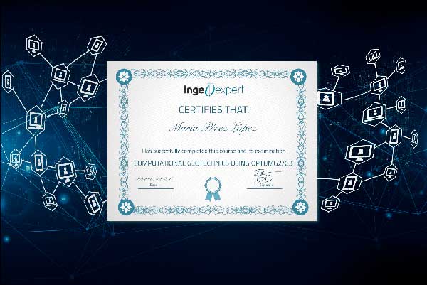
Blockchain technology makes the certificate incorruptible, enabling companies to verifiy its autenticity.
Martial Abe –
Love the way this course is structured and the platform.
Thank to Dr Michael Behm, more available and his ease of teaching the course.
Complete knowledge about Geophysical methods, their applications/limitations (Seismic, GPR, ERT/IP, EM, Grav/Mag).
I also get a great knowledge about practical aspects of any geophysical survey from project definitions to delivereables (results).
Damian Pasiecznik –
This course is a very good introduction to the various geophysical methods that one can apply for engineering, construction an mining. I would recommend it to any colleague interested in understanding the near-surface using geophysical techniques.
The course is very well taught by an excellent professor. He has no problems on answering questions within the webinars or by mail during the week.
Jessica Garate –
The course was laid out clearly and the content included theory as well as real-world applications. Extra reading from journals was also available for those who wanted to dig deeper. I appreciate the effort the professor put in to explain and answer questions during webinars. Great way to learn quickly! Highly recommend.
Frid NZENGUE DIBA –
The high-quality materials, the insightful discussions with Michael, and especially the sharing of experience made this course ideal for selecting the most appropriate geophysical method for a given problem.