
UAV photogrammetry for Earth Observation course
Online course |
|
50 hours / 6 weeks |
|
To be determined |
Introduction
Nowadays, Unmanned Aerial Vehicles (UAVs) as a progressing technology is promoting Earth Observation science radically and has changed our way of generating geospatial information drastically. UAVs represent a valid alternative to airborne and terrestrial data acquisition protocols in many applications. Their flexibility and relatively reduced cost have made UAV a valid instrument for variability of applications, contributing to increase the interest in geospatial technologies among broader audience. Moreover, the introduction of automated and intuitive open-source and commercial software for photogrammetric processing has enabled many (often unexperienced) practitioners to adopt UAVs in their everyday surveying activities.
Consequently, this course focuses on basic concepts, acquisition, and processing procedures of Earth Observation (EO) using UAVs; mainly known as UAV photogrammetry. The knowledge and competences acquired, are also applicable to any other passive EO sensor.
Theoretical concepts and practical workflows are provided to enable students to handle a UAV photogrammetry project from flight planning to 3D model product generation. The course is designed to be fully online and based on self-study. Limited scheduled contact hours and online discussion boards are implemented to make sure that instructors can fully support the students’ progress.
Objectives
Upon completion of this course, students will be able to:
- Explain the basic characteristics of Earth Observation sensors, obtained data visualization and colour systems principals
- Understand and describe the application for Earth Observation with specific attention to UAV photogrammetry specifically for urban planning, agriculture, energy monitoring, 3D modelling, and map generation
- Describe the theoretical concepts of photogrammetric processing steps for UAV based cameras (RGB, Multi spectral, Thermal) and to know how to process and generate products based on them
- Design and plan drone missions and control the radiometric and geometric quality of captured images.
- Practice a complete UAV photogrammetry processing chain from captured images to generate products such as orthophoto mosaics, points clouds, DSM, and DTM based on Pix4d processing package.
- Assess the quality of UAV photogrammetry processing chain and extracted products for some selected applications (3D modelling, smart agriculture, disaster management).
- Investigate and practice two main applications of UAVs; smart agriculture and civil engineering
Lectures:
- – Introduction to the course (1 hour)
- – Introduction to UAVs (2 hours)
- – Vision, color composition and EO Sensors and Platforms (3 hours)
- – UAV flight planning (2 hours)
- – Principles of photogrammetry and product generation form EO data (8 hours)
- – Selected application for UAV photogrammetry (6 hours)
Practical:
-
- – Practical on flight planning (2 hours)
- – Practical exercise: photogrammetric based Pix 4D; Photogrammetric processing and product generation (8 hours)
- – Practice selected application for UAV photogrammetry (4 hours)
- – Total hours of lecture: 21 hours
- – Total hours of Practical: 14 hours
- – Total hours of self-study: 15
- – Course duration: 5 weeks
- – Contact hours: Five online webinars, one per week, each one for 1 hour
- – Offline Q&A: discussion board and forums
- – Assessment: not included
- – Provided materials: lectures, manuals, practical assignments, sample data
Farzaneh Dadrass Javan, Ph.D., (Univ. of Twente, The Netherlands)
Farzaneh is working as a lecturer in the Earth Observation Science (EOS) Department at the University of Twente. She got her MSc in Photogrammetry in 2009 from the University of Tehran and also her Ph.D. in Photogrammetry from the same university in 2012. As her passion for teaching and being involved in research, Farzaneh started her job as an assistant professor at the University of Tehran in the Photogrammetry and Remote Sensing department, 2016 – 2020. Afterward, in September 2020 she started her career as a lecturer at the University of Twente. During her working years, she has been involved in a variety of teaching and research activities and supervised more than 20 M.Sc. and Ph.D. thesis which resulted in over 60 publications in international journals and conferences with a Citation score of (h-index) 9. She is teaching and doing research mainly in Photogrammetry and Remote sensing and recently she is more focused on UAV photogrammetry applications, especially in agriculture and 3D modeling.
Yolla Al Asmar, M.Sc., (Univ. of Twente, The Netherlands)
Yolla Al Asmar is a lecturer at the Earth Observation Science department. She has been working in ITC since 2015. She has a Master of Science degree in Applied Geoinformatics in 2015 from ITC. In addition, she holds a Master’s degree in Photogrammetry and Geoinformatics from Stuttgart University of Applied Sciences, Germany, where she graduated in 2008. During her studies and work experiences in both the education and private and public sectors, she gained significant skills and knowledge in the fields of geo-information science and digital Photogrammetry, among others.
Bashar Alsadik, Ph.D., (Univ. of Twente, The Netherlands)
Bashar is an assistant professor of photogrammetry at the ITC faculty – at the University of Twente in the Netherlands. His main research interests are in photogrammetry, mobile mapping, and Geomatics. He has worked in the academic and industrial sectors for more than 20 years.
He is the author of an Elsevier book entitled (Adjustment Models in 3D Geomatics and Computational Geophysics) and the first author of more than 25 scientific papers in journals and ISPRS conferences.
All of our courses are offered 100% online, through our intuitive Virtual Campus. Topics are taught through:
- – Videos
- – Interactive multimedia content
- – Live classes
- – Texts
- – Case studies
- – Evaluation exercises
- – Additional documentation
The content is updated in each new course edition, so that knowledge is acquired around the latest news and state-of-the-art geotechnical engineering technology.
One of the most interesting aspects of our courses is the use of live videoconferences, in which teachers and students interact in a continuous exchange of knowledge and problem solving. In addition to this, students can make use of the platform’s forum, a meeting point where they can interact with teachers and other students.
A tutoring system will also be established by email, which will resolve any possible doubts about the course, and which will serve as a point of connection for students with specific questions on each module.
Students can also download all course documentation, including texts, videos, video conferences and exercises.
This course is open for technicians, experts, fresh B.Cs. or M.Sc. graduates or students who are interested to achieve theoretical and practical knowledge on how UAVs can help with thematic and geo-spatial data acquisition and processing. Experience as drone pilot is not required but pre-knowledge of geospatial data is highly recommended. Experts from governmental section who seek a new solution to the current problem are also welcomed. This course is highly recommended for audiences from other disciplines specially (but not limited to):
- – Geo-spatial science
- – Surveying
- – Construction
- – Agriculture
- – Geology
- – Mining
- – Archaeology
- – Cultural heritage
At the end of the course, and as accreditation of knowledge acquired and of the technical and practical training, students who correctly complete the corresponding evaluation tests of the geotechnical engineering course will obtain an academic certificate issued by Ingeoexpert. This digital certificate is protected by Blockchain technology, making it unique and tamper-proof, thus enabling companies to verify its authenticity.
It can also be downloaded by students, forwarded by email and shared on social networks, as well as embedded on any website. You can see an example here.
UAV is a progressing technology promoting earth observation science more and more. Moreover, EO science concentrated on data gathering and geospatial information generation which can contribute to lots of applications and disciplines. 3D models, maps, orthophotos, thematic information, points clouds and lots of other products are nowadays generated with a higher accuracy thanks to the availability of high technology solutions, especially drones.
UAVs can help experts from other disciplines to gather the information they needed for their application to be more reliable, less expensive, more accurate, or within a shorter time. UAVs also offer lots of flexibility and capabilities that can also offer new solutions to current problems that exist in other disciplines.
Students after attending this course are familiar with the UAV concept and its application for data gathering, processing, and information generation which can help them with their job prospects in different fields such as geoinformation, urban planning and monitoring, construction, agricultural engineering, cultural heritage, mining and so on.
More info
Finish this course and get a certificate based on Blockchain
UAV photogrammetry for Earth Observation course
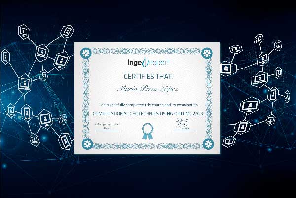
Blockchain technology makes the certificate incorruptible, enabling companies to verifiy its autenticity.
Reviews
There are no reviews yet.